An Entirely New & Accurate Survey Of The County Of Kent, With Part Of The County Of Essex,
by William Mudge, 1801.
~ Click Here To View The Map Image Without Borders ~
The Map
| Map Title: |
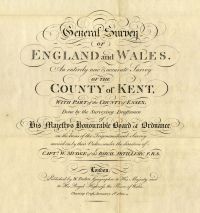
General Survey OF ENGLAND and WALES. An entirely new & accurate Survey OF THE COUNTY of KENT, WITH PART of the COUNTY of ESSEX, Done by the Surveying Draftsmen of His Majesty's Honourable Board of Ordnance, on the basis of the Trigonometrical Survey carried on by their Orders under the direction of CAPTN. W. MUDGE of the ROYAL ARTILLERY. F.R.S. |
|
| Map Dedication: |
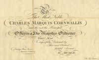
To The Most Noble CHARLES MARQUIS CORNWALLIS and the rest the Principal Officers of His Majesty's Ordnance THIS MAP Is respectfully Dedicated by Their most Obedient & faithful Servant W. MUDGE.
Drawing Room Tower. January 1st. 1801.
Thos. Foot Engraver. |
| Slipcase Label: |
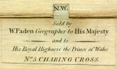
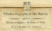
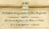
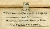
Kent. Sold by Wm. Faden, Geographer to the King, Charing Cross. |
| Mapmaker: |
Captain William Mudge
|
| Publisher: |
Published by W. Faden, Geographer to His Majesty and to His Royal Highness the Prince of Wales. Charing Cross, January, 1st. 1801
|
| Date: |
1 January 1801 |
| Size: |
122cm x 177.5cm (48" x 70") |
| Scale: |
1" : 1 statute mile |
| Description: |
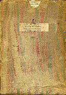
4 folding maps, dissected and laid down on linen, in original marbled slipcase. Minimal hand colouring to coach roads. |
This highly detailed map of Kent is now known as The Mudge Map, and was the first Ordnance Survey map to be published. The survey was commenced in the 1790s by the Board of Ordnance (later the Ministry of Defence), in response to the feared invasion of England by the French. Kent, the first Ordnance Survey map, was published on 1st January 1801 by William Faden, Geographer to the
King. Faden's Topographical Map Of The Country Twenty Miles Round London, Planned From A Scale Of Two Miles To An Inch is displayed elsewhere on the MAPCO site.
Mudge's efforts were followed by Major Thomas Colby, whose work on the great Ordnance Survey project of the early 19th century is well known. Copies of Colby's maps will eventually be displayed on the MAPCO website.
Place Name Search Feature
This map is the first on the MAPCO website to include a comprehensive search feature for place names. The search feature is located at the top right of each page, with a search box containing the words "Search This Map". The Search Engine enables a targeted search of the entire 1801 map of Kent.
You can start your search of the map of the County of Kent here:
Please note that this is not a general search engine for the entire MAPCO website, but is targeted specifically at the map currently being viewed. The entire MAPCO site can be searched using the Google Search Engine on the Search Help page.
The Search Engine has also compiled a Complete Index Of Kent Place Names, which is well worth referring to.
Kent Place Names Transcription Project
Transcription of the place names from the 1801 map of Kent was generously carried out by a team of eager volunteers. I owe a debt of gratitude to all involved for their enormous efforts in making this such a success, enabling the implementation of the Search Engine for this map.
My sincere thanks go to the following transcribers for all of their help:
Tony Allnutt
Sally Brady
Jim Clay
Derek Crompton
Jane Knipe
Judy Lester
Richard Rowe
Dave Stokes
David Wright
Thank you!
Take a look at the Place Names Transcription Project page to see how the project was carried out.
|


