London and Environs Maps and Views
There are currently 73 high quality London maps and views displayed on this site.
"Sir, when a man is tired of London he is tired of life: for there is in London all that life can afford."
Samuel Johnson (1709-1784)
| FEATURED MAPCO MAP OF LONDON |
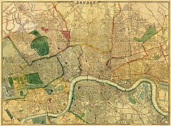
| ~ Map Of London 1868, By Edward Weller, F.R.G.S. ~ |
|
This is one of the largest maps to be displayed on the MAPCO website. The detail is amazing. Cassell, Petter & Galpin, who had previously published the map in 1863, declared that their "large map of London, as well as being the largest, is universally admitted to be the best map of London ever produced". This highly detailed map is on a very large scale of 9⅜" to
1 Statute Mile.
This map has its own domain name:
london1868.com
Chosen because it is simple to remember, this is an easy way to access the map directly.
The map can still be reached via the MAPCO website. Similarly the MAPCO website can still be accessed through the Map Of London 1868 website. The map is still part of the MAPCO : Map And Plan Collection Online website.
Do take a look at this wonderful map. The detail is truly stunning! |
| London 100s - 2nd Century |
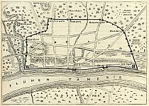
Map Of Roman London
Post AD190
|
| Full Title: |
|
| Year: |
After AD190 |
| Publisher: |
Cassell and Company, Limited. London, Paris and Melbourne. 1897. |
| Date: |
1897 |
| Source: |
Taken from "Old and New London. A Narrative of Its History, Its People, And Its Places. Illustrated with numerous Engravings from the most Authentic Sources. The City, Ancient And Modern", by Walter Thornbury. Vol. I. 1897. |
| Notes: |
A 19th century plan of Roman London, after the destruction of Londinium by the forces of Boudica circa AD62.
This late 19th century map of London records the main features of Roman London. Various sources are cited by Thornbury in relation to the creation of this plan.
The Romans built a defensive wall around the landward side of the city of Londinium sometime between 190 and 225. This map of Roman London shows London Wall, thus dating it post AD190.
|
|
| London 1500s - 16th Century |
Map Of London
c1560

|
| Full Title: |
|
| Map-Maker: |
Attributed to Ralph Agas c1560 |
| Publisher: |
This facsimile published by Adams And Francis, London |
| Date: |
1874 |
| Size: |
75cm x 185cm (29½" x 72¾") |
| Scale: |
c.28" : 1 statute mile |
| Extent: |
Finsbury Field - Aldgate - Bankside - St. James's Park |
| Description: |
Engraved and Published from the Agas map held in the Guildhall
Library. Paper on linen, but not dissected, folded unevenly. Includes reference
letters and numbers on many buildings, but there is no key to these. Includes
notes by W.H. Overall, F.S.A., Librarian To The Corporation Of London. |
|
Map Of London
c1560

|
| Full Title: |
|
| Map Maker: |
John Strype |
| Date: |
1720 |
| Size: |
45cm x 17.5cm (19½" x 9") |
| Source: |
Engraved for Stow's Survey of London (1720). See (2) below for details. |
| Extent: |
Moorfields - Limehouse - St Georges, Southwark - St James's Park. |
| Description: |
Original engraved print on paper with later hand colouring. In excellent condition.
Based on a map of London attributed to Ralph Agas. Refer to Howgego No. 2 (a) for details of Hatton's version of this map. |
|
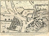
Map Of Charing Cross 1578
|
| Full Title: |
|
| Map Maker: |
John Thomas Smith |
| Date: |
1578 |
| Source: |
Taken from "Antiquities Of The City Of Westminster" by John Thomas Smith, 1807; containing "Sixty-Two Additional Plates To Smiths Antiquities Of Westminster" by John Thomas Smith, c1809. |
| Publisher: |
London. Published as the Act directs, February 24th, 1808, by John Thomas Smith, No. 31, Castle Street East, Oxford Street.
|
| Plate Size: |
19.8cm x 26.5cm (7¾" x 10¼" Approx) |
| Extent: |
Hedge Lane - Strand - Scotland Yard - St James's Park |
| Notes: |
Copied from Agas's Map Published 1578, centred on Charing Cross.
The caption below the map reads:
The Village Of Charing, &c.: From Radulphus Aggas's Map, Taken In The Reign Of Queen Elizabeth, 1578. |
|
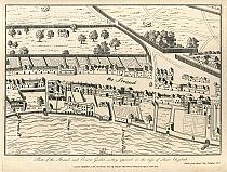
Map Of Strand 1578
|
| Full Title: |
|
| Map Maker: |
John Thomas Smith |
| Date: |
1578 |
| Source: |
Taken from "Antiquities Of The City Of Westminster" by John Thomas Smith, 1807; containing "Sixty-Two Additional Plates To Smiths Antiquities Of Westminster" by John Thomas Smith, c1809. |
| Publisher: |
London. Published as the Act directs, June 29, 1809, by John Thomas Smith, No. 4, Polygon, Somers Town.
|
| Plate Size: |
20.5cm x 26.8cm (8" x 10½" Approx) |
| Notes: |
The caption below the map reads:
Copied from Aggas's Map Published 1578. |
|
Map Of Westminster 1578
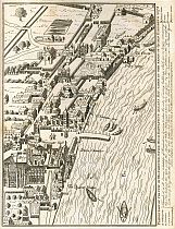
|
| Full Title: |
|
| Map Maker: |
John Thomas Smith |
| Date: |
1578 |
| Source: |
Taken from "Antiquities Of The City Of Westminster" by John Thomas Smith, 1807; containing "Sixty-Two Additional Plates To Smiths Antiquities Of Westminster" by John Thomas Smith, c1809. |
| Publisher: |
London. Published as the Act directs, December 26th, 1807, by John Thomas Smith, No. 31, Castle Street East, Oxford Street. |
| Plate Size: |
20.6cm x 26.6cm (8" x 10½" Approx) |
| Extent: |
Scotland Yard - The River Thames - Palace Gardens - St James's Park |
| Notes: |
The caption below the map reads:
Plan Of Part Of The City Of Westminster, Copied From Radulphus Aggas's Map, Taken In The Reign Of Queen Elizabeth, 1578. |
|
Map Of Westminster
1593
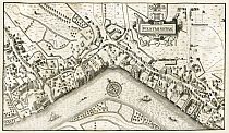
|
| Full Title: |
|
| Year: |
1593 |
| Publisher: |
J. Coxhead Holywell Street, Strand, Jany 1st 1813. |
| Date: |
1813 |
| Source: |
Engraved for "The History And Antiquities Of London" Vol.1, by Thomas Pennant, Esq. London 1813. |
| Notes: |
Copied from John Norden's plan of 1593 (see Smith's Antiquities 1807). |
|
Map Of London 1593
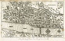
|
| Full Title: |
|
| Year: |
1593 |
| Publisher: |
J. Coxhead Holywell Street, Strand, Jany 1st 1813. |
| Date: |
1813 |
| Source: |
Engraved for "The History And Antiquities Of London" Vol.1, by Thomas Pennant, Esq. London 1813. |
| Notes: |
Copied from John Norden's plan of 1593. |
|
Map Of Westminster 1593
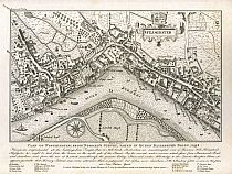
|
| Full Title: |
|
| Map Maker: |
John Thomas Smith |
| Date: |
1593 |
| Source: |
Taken from "Antiquities Of The City Of Westminster" by John Thomas Smith, 1807; containing "Sixty-Two Additional Plates To Smiths Antiquities Of Westminster" by John Thomas Smith, c1809. |
| Publisher: |
London. Published as the Act directs, February 20th, 1808, by John Thomas Smith, No. 31, Castle Street East, Oxford Street. |
| Plate Size: |
26.5cm x 20.4cm (10½" x 8" Approx) |
| Extent: |
Way To St Giles' - Temple Stairs - Lambeth House - Millbank |
|
| London 1600s - 17th Century |
View Of London 1616
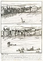
|
| Full Title: |
|
| Map Maker: |
John Thomas Smith |
| Date: |
1616 |
| Source: |
Taken from "Antiquities Of The City Of Westminster" by John Thomas Smith, 1807; containing "Sixty-Two Additional Plates To Smiths Antiquities Of Westminster" by John Thomas Smith, c1809. |
| Publisher: |
London. Published as the Act directs, June 3d, 1809, by John Thomas Smith, No. 4, Polygon, Somers Town. |
| Plate Size: |
23.7cm x 30.3cm (9½" x 12" Approx) |
| Extent: |
Garden Stairs - Whitefriars Stairs |
| Notes: |
Copied from Claes Jansz Visscher's panorama of London c1616. |
|
Map Of London 1643
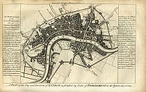
|
| Full Title: |
|
| Map Maker: |
Walter Harrison |
| Date: |
1666 |
| Source: |
Engraved for "A New and Universal History, Description, and Survey Of The Cities Of London and Westminster, The Borough of Southwark, And Their Adjacent Parts. Including not only all the Parishes within the Bills of Mortality, but the Towns, Villages, Palaces, Seats, and Country, to the extent of Twenty Miles round, Comprizing A Circle Of Near One Hundred And Fifty Miles" By
Walter Harrison, Esq. 1775. |
| Publisher: |
London. Published for Harrison's History of London. 1775.
Printed for J. Cooke, at Shakespeare's Head, Pater-Noster-Row. 1775. |
| Plate Size: |
31.5cm x 20.9cm (12½" x 8¼" Approx) |
| Extent: |
Shoreditch - Stepney - Vauxhall - Constitution Hill |
| Notes: |
Includes "An Explanation of the several Forts on the Line of Communication", which details all 23 forts on the London wall. |
|
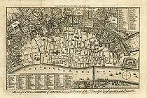
London Fire.
Map Of Liberties Of London
1666
|
| Full Title: |
|
| Map Maker: |
John Noorthouck |
| Date: |
1772 |
| Source: |
Taken from "A New History of London, Including Westminster and Southwark, to which is added, A General Survey of the Whole; Describing The Public Buildings, Late Improvements, &c. Illustrated WIth Copper-Plates." by John Noorthouck. London, 1773. |
| Publisher: |
Printed for R. Baldwin, 47, Pater-Noster Row. 1773. |
| Size: |
20cm x 32.7cm (8" x 13" Approx) |
| Scale: |
6¾" : 1 Statute Mile (Approx) |
| Extent: |
Bun Hill - East Smith Field - Southwark - Grays Inn Lane |
| Description: |
Folding map showing the extent of the Great Fire of London, engraved for Noorthouck's History of London 1772. Includes a Reference To All The Churches Both In The City And Suburbs, and a Reference To Remarkable Places.
Based on Wenceslaus Hollar's 1666 map of the Great Fire of London entitled A Map or Groundplot of the City of London and the Suburbes thereof, that is to say, all which is within the Jurisdiction of the Lord Mayor or properlie calld't London by which is exactly demonstrated the present condition thereof, since the last sad accident of fire. The blank space signifeing the burnt part & where the
houses are exprest, those places yet standing.
As described by the lengthy title above, the blank part of the map clearly shows the extent of the Great Fire.
This map is represented in Howgego as No. 19, Derivative (b).
|
|
|
|
Plan For Rebuilding Of London 1666
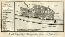
|
| Full Title: |
|
| Map Maker: |
Walter Harrison |
| Date: |
1666 |
| Source: |
Engraved for "A New and Universal History, Description, and Survey Of The Cities Of London and Westminster, The Borough of Southwark, And Their Adjacent Parts. Including not only all the Parishes within the Bills of Mortality, but the Towns, Villages, Palaces, Seats, and Country, to the extent of Twenty Miles round, Comprizing A Circle Of Near One Hundred And Fifty Miles" By
Walter Harrison, Esq. 1775. |
| Publisher: |
London. Published for Harrison's History of London. 1775.
Printed for J. Cooke, at Shakespeare's Head, Pater-Noster-Row. 1775. |
| Plate Size: |
29.8cm x 17cm (11¾" x 6½" Approx) |
| Notes: |
Proposed rebuilding plan of London in the wake of the Great Fire of London, 1666. |
|
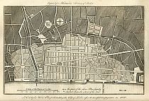
Plan For Rebuilding Of London 1666
|
| Full Title: |
|
| Map Maker: |
Walter Harrison |
| Date: |
1666 |
| Source: |
Engraved for "A New and Universal History, Description, and Survey Of The Cities Of London and Westminster, The Borough of Southwark, And Their Adjacent Parts. Including not only all the Parishes within the Bills of Mortality, but the Towns, Villages, Palaces, Seats, and Country, to the extent of Twenty Miles round, Comprizing A Circle Of Near One Hundred And Fifty Miles" By
Walter Harrison, Esq. 1775. |
| Publisher: |
London. Published for Harrison's History of London. 1775.
Printed for J. Cooke, at Shakespeare's Head, Pater-Noster-Row. 1775. |
| Plate Size: |
29cm x 21cm (11½" x 8¼" Approx) |
| Notes: |
Proposed rebuilding plan of London in the wake of the Great Fire of London, 1666. |
|
Map Of London 1677
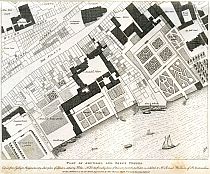
|
| Full Title: |
|
| Map Maker: |
John Thomas Smith |
| Date: |
1677 |
| Source: |
Taken from "Antiquities Of The City Of Westminster" by John Thomas Smith, 1807; containing "Sixty-Two Additional Plates To Smiths Antiquities Of Westminster" by John Thomas Smith, c1809. |
| Publisher: |
London. Published as the Act directs, Augt 20. 1808, by John Thomas Smith, No. 31, Castle Street East, Oxford Street. |
| Plate Size: |
30.3cm x 25.2cm (12" x 10" Approx) |
| Notes: |
The caption below the map reads:
Plan Of Arundel And Essex Houses.
Copied from Ogilby's & Morgan's twenty-sheet plan of London, etched by Hollar. - N.B. For the friendly loan of this rare print the publisher is indebted to Mr Samuel Woodburn, of St Martin's Lane.
London. Published as the Act directs, Augt 20. 1808, by John Thomas Smith, No. 31, Castle Street East, Oxford Street. |
|
Map Of London c1690
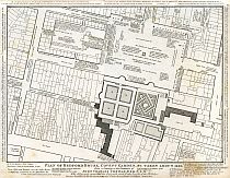
|
| Full Title: |
|
| Map Maker: |
John Thomas Smith |
| Date: |
1677 |
| Source: |
Taken from "Antiquities Of The City Of Westminster" by John Thomas Smith, 1807; containing "Sixty-Two Additional Plates To Smiths Antiquities Of Westminster" by John Thomas Smith, c1809. |
| Publisher: |
London. Published as the Act directs, 30 May. 1809, by John Thomas Smith, No. 4, Polygon, Somers Town. |
| Plate Size: |
31.4cm x 24.5cm (12½" x 9¾" Approx) |
| |
|
|
| London 1700s - 18th Century |
Map Of London
1700
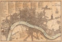
|
| Full Title: |
|
| Map-Maker: |
Charles Inselin sculpt. |
| Publisher: |
Nicholas De Fer, Paris. 1700. |
| Date: |
1700 |
| Size: |
22.2cm x 33cm (8¾" x 13") |
| Scale: |
3" : 1 Statute Mile (Approx) |
| Extent: |
Old Street - Ratcliff Cross - Kennington - St. James's Park |
| Description: |
Early plan of London, in French. Key reference table identifying 113 locations throughout London. |
|
Map Of London
1720
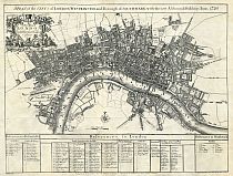
|
| Full Title: |
|
| Map-Maker: |
S. Parker delin et sculpt. Revised by John Senex |
| Publisher: |
Cassell & Company Limited, La Belle Sauvage, Ludgate Hill, London, E.C. |
| Date: |
c1880 |
| Size: |
53cm x 71cm (21" x 28") |
| Scale: |
5½" : 1 statute mile / Scale bar c. 2½" : 1 statute mile |
| Extent: |
New River Head - Whitechapel - Lambeth - Buckingham
House |
| Description: |
Title across top of map. References across
bottom of map. Dedication title in cartouche with City arms and insignia, pennons,
cornucopiae, etc., at top left. Compass rose and scale at bottom centre. Dedicated
to Sir Peter Delme, Knight and Alderman. |
|
Map Of London 1734
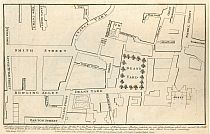
|
| Full Title: |
|
| Map Maker: |
John Thomas Smith |
| Date: |
1734-1748 |
| Source: |
Taken from "Antiquities Of The City Of Westminster" by John Thomas Smith, 1807; containing "Sixty-Two Additional Plates To Smiths Antiquities Of Westminster" by John Thomas Smith, c1809. |
| Publisher: |
London. Published as the Act directs, September 10th, 1807, by John Thomas Smith, No. 31, Castle Street East, Oxford Street. |
| Plate Size: |
26.5cm x 16.9cm (10½" x 6½" Approx) |
| Extent: |
Dart Entry - Broken Cross - Barton Street - Peter Street |
|
London Fire.
Plan Of Cornhill Fire
1748
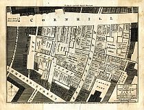
|
| Full Title: |
|
| Publisher: |
The London Magazine, or, Gentleman's Monthly Intelligencer.
London. Published for R. Baldwin, jun. at the Rose in Pater-Noster-Row. |
| Date: |
MDCCXLVIII. 1748. |
| Size: |
25.5cm x20.7cm (10" x 8")
|
| Source: |
Engraved For The London Magazine
|
| Scale: |
1" : 18 Yards (Approx.) |
| Extent: |
Royal Exchange, Cornhill - St Michael's Church, St Michael's Alley - Abchurch Lane - Pope's Head Alley |
| Description: |
Single page from The London Magazine, The Monthly Chronologer section. Printed one side only. Fair/Good condition. Minor discolouration and foxing.
|
|
Map Of Southwark & Lambeth
1753
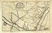
|
| Full Title: |
|
| Map Maker: |
Anon. |
| Date: |
1753 |
| Source: |
Taken from Gentlemanís Magazine, May 1753 |
| Publisher: |
Gentlemanís Magazine, May 1753 |
| Plate Size: |
23cm x 36.5cm Approx (9" x 14½" Approx) |
| Extent: |
Narrow Wall - The Tower - Walworth - Westminster |
|
Map Of Paddington To Islington
1756

|
| Full Title: |
|
| Publisher: |
B.Cole Sculp |
| Date: |
January 1756 |
| Size: |
49cm x 20cm (19¼" x 8")
|
| Source: |
Engraved For The Gentlemans Magazine
|
| Scale: |
1" : 900 Feet (Approx.) |
| Extent: |
Jews Harp House - Dobney's Bowling Green - Lincolns Inn - Bell Lane |
| Description: |
Folding plan on 19th century paper. Explanation at bottom left. Title at top right. Very good condition. |
|
London Fire.
Plan Of Bishopsgate Fire
1765
|
| Full Title: |
|
| Publisher: |
Gentleman's Magazine |
| Date: |
1765 |
| Size: |
11cm x16.5cm (4¼" x 6½")
|
| Source: |
Engraved For The Gentleman's Magazine
|
| Scale: |
1" : 27 Yards (Approx.) |
| Extent: |
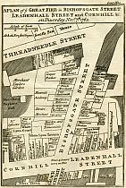
South Sea House, Threadneedle Street - Bull Inn, Leadenhall Street -
St. Peter's Church, Gracechurch Street - Sun Court, Cornhill |
| Description: |
Single page from The Gentleman's Magazine. Printed one side only. Good condition. No offsetting or foxing. |
|
Map Of London
1767
|
| Full Title: |
|
| Publisher: |
Anonymous |
| Date: |
1767 |
| Size: |
54cm x 32cm (21" X 12¾")
|
| Scale: |
4¼" : 1 statute mile |
| Extent: |
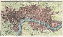
New River Head - Shadwell - Newington Butts
- Hide Park. |
| Description: |
Folding plan on 18th century paper. Hand
coloured. Title set in top margin. |
|

Map Of London
1772
|
| Full Title: |
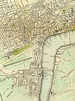
A Plan Of The Cities Of London And Westminster, And Borough Of Southwark. Engraved for Noorthouck's History of London 1772. |
| Publisher: |
Printed for R. Baldwin, 47, Pater-Noster Row. 1773. |
| Date: |
1772
|
| Size: |
|
| Scale: |
|
| Extent: |
|
| Source: |
Taken from "A New History of London, Including Westminster and Southwark, to which is added, A General Survey of the Whole; Describing The Public Buildings, Late Improvements, &c. Illustrated WIth Copper-Plates." by John Noorthouck. London, 1773. |
| Notes: |
Ashby Sculp. |
|
Map Of London 1772
|
| Full Title: |
|
| Map Maker: |
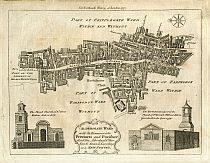
John Noorthouck |
| Date: |
1772 |
| Source: |
Taken from "A New History of London, Including Westminster and Southwark, to which is added, A General Survey of the Whole; Describing The Public Buildings, Late Improvements, &c. Illustrated With Copper-Plates." by John Noorthouck. London, 1773. |
| Publisher: |
Printed For Noorthouck's History Of London 1772.
Printed for R. Baldwin, 47, Pater-Noster Row. 1773. |
| Plate Size: |
25cm x 19.5cm (10" x 7½" Approx) |
|
Map Of London 1772
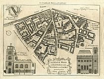
|
| Full Title: |
|
| Map Maker: |
John Noorthouck |
| Date: |
1772 |
| Source: |
Taken from "A New History of London, Including Westminster and Southwark, to which is added, A General Survey of the Whole; Describing The Public Buildings, Late Improvements, &c. Illustrated With Copper-Plates." by John Noorthouck. London, 1773. |
| Publisher: |
Printed For Noorthouck's History Of London 1772.
Printed for R. Baldwin, 47, Pater-Noster Row. 1773. |
| Plate Size: |
25cm x 19cm (9¾" x 7½" Approx) |
|
Map Of London 1772
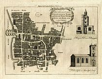
|
| Full Title: |
|
| Map Maker: |
John Noorthouck |
| Date: |
1772 |
| Source: |
Taken from "A New History of London, Including Westminster and Southwark, to which is added, A General Survey of the Whole; Describing The Public Buildings, Late Improvements, &c. Illustrated With Copper-Plates." by John Noorthouck. London, 1773. |
| Publisher: |
Printed For Noorthouck's History Of London 1772.
Printed for R. Baldwin, 47, Pater-Noster Row. 1773. |
| Plate Size: |
25cm x 19cm (9¾" x 7½" Approx) |
| Notes: |
Includes the north end of old London Bridge, Pudding Lane, and the Monument.
|
|
Map Of London 1772
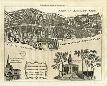
|
| Full Title: |
|
| Map Maker: |
John Noorthouck |
| Date: |
1772 |
| Source: |
Taken from "A New History of London, Including Westminster and Southwark, to which is added, A General Survey of the Whole; Describing The Public Buildings, Late Improvements, &c. Illustrated With Copper-Plates." by John Noorthouck. London, 1773. |
| Publisher: |
Printed For Noorthouck's History Of London 1772.
Printed for R. Baldwin, 47, Pater-Noster Row. 1773. |
| Plate Size: |
25cm x 19cm (9¾" x 7½" Approx) |
|
Map Of London 1772
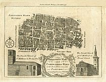
|
| Full Title: |
|
| Map Maker: |
John Noorthouck |
| Date: |
1772 |
| Source: |
Taken from "A New History of London, Including Westminster and Southwark, to which is added, A General Survey of the Whole; Describing The Public Buildings, Late Improvements, &c. Illustrated With Copper-Plates." by John Noorthouck. London, 1773. |
| Publisher: |
Printed For Noorthouck's History Of London 1772.
Printed for R. Baldwin, 47, Pater-Noster Row. 1773. |
| Plate Size: |
25cm x 19cm (9¾" x 7½" Approx) |
|
Map Of London 1772
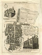
|
| Full Title: |
|
| Map Maker: |
John Noorthouck |
| Date: |
1772 |
| Source: |
Taken from "A New History of London, Including Westminster and Southwark, to which is added, A General Survey of the Whole; Describing The Public Buildings, Late Improvements, &c. Illustrated With Copper-Plates." by John Noorthouck. London, 1773. |
| Publisher: |
Printed For Noorthouck's History Of London 1772.
Printed for R. Baldwin, 47, Pater-Noster Row. 1773. |
| Plate Size: |
18.6cm x 24cm (7¼" x 9½" Approx) |
|
Map Of London 1772
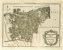
|
| Full Title: |
|
| Map Maker: |
John Noorthouck |
| Date: |
1772 |
| Source: |
Taken from "A New History of London, Including Westminster and Southwark, to which is added, A General Survey of the Whole; Describing The Public Buildings, Late Improvements, &c. Illustrated With Copper-Plates." by John Noorthouck. London, 1773. |
| Publisher: |
Printed For Noorthouck's History Of London 1772.
Printed for R. Baldwin, 47, Pater-Noster Row. 1773. |
| Plate Size: |
23.5cm x 18.2cm (9¼" x 7¼" Approx) |
|
Map Of London
1775
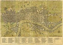
** With Full Street Search **
|
| Map Title: |
|
| Slipcase Label: |
A New Plan Of London 1777.
Printed For Carington Bowles in St Pauls Church Yard.
|
| Mapmaker: |
Carington Bowles
|
| Publisher: |
Printed for Carington Bowles, at his Map and Print-Warehouse, No. 69 in St Paulís Church Yard, London.
|
| Engraver: |
Engraved by J. Ellis, Clerkenwell, London. |
| Date: |
Published as the Act directs, 30 March, 1773 |
| Date of Map: |
Updated to 1775 |
| Size: |
39.3cm x 55cm (15½" x 21¾") |
| Scale: |
4" : 1 mile |
| Extent: |
Islington - Shadwell - Newington Butts - Knightsbridge |
| Description: |
Scale & compass rose bottom right. Imprint & table of references to churches and principal buildings located below map. |
|
Map divided into squares lettered along margins for reference. Built-up areas stippled in city, hatched elsewhere ( Howgego pp 126).
This is a 1775 map in a later 1777 slipcase. This copy is an earlier state than the first known copy recorded in Howgego as No. 168 (1). |
|
Turnpike Gates In The Vicinity Of London
1790
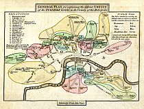
|
| Full Title: |
|
| Map Maker: |
John Cary |
| Date: |
Published By J. Cary, July 1st, 1790. |
| Source: |
Taken from: Cary's Survey Of The High Roads From London To Hampton Court, Bagshot, Oakingham, [and twenty-three other places in the neighbourhood of the metropolis.] On a Scale of one Inch to a Mile; wherein Every Gentleman's Seat, situate on, or seen from the Road, (however distant) are laid down, with the Name of the Possessor; to which is added The Number
Of Inns on each separate Route; also, The different Turnpike Gates, shewing The Connection which one trust has with another.
London: Printed for J. Cary, Engraver & Map seller, the corner of Arundel Street, Strand. July 1st. 1790. |
| Size: |
22cm x 15.6cm (8½" x 6¼" Approx) |
| Scale: |
1" : 1¼ Miles (Approx) |
| Extent: |
Clapton Gate - Deptford Gate - Camberwell Gate - Kensington Gate |
| Description: |
Hand coloured map on paper. Good condition with some foxing, offset and staining.
Single page map showing the main thoroughfares of London in 1790, with every turnpike, and the area of every turnpike trust shown by a different colour. The Thames, the turnpike gates, and the areas of the trusts are coloured.
The title is in a raised panel along the top of the map. In the upper two corners are the names of the gates with references by numbers and references to the colours on the map, and other notes. Imprint details in panel below map.
Source: ( Fordham pps. 40-41).
|
|
Map Of London
1795
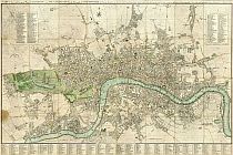
|
| Full Title: |
|
| Publisher: |
John Cary, Map & Print-seller, No. 188, corner of Arundel Street, Strand. |
| Date: |
January 1st, 1795 |
| Size: |
125cm x 81.5cm (49¼" x 32") |
| Scale: |
6½" : 1 statute mile |
| Extent: |
Canonbury - Limehouse - Kennington - Kensington |
| Description: |
Folding map. Slipcase torn and in poor condition, though label is better preserved. Map consists of hand coloured sections laid down on linen. Map title above top border. Table of references to public buildings at top left, and to churches at top right. The map is divided into squares numbered for reference. The main table of references is below the map outside the border.
There is no key to the stippling or symbols used ( Howgego pp134-5). |
|
Map Of Surrey Docks
1799
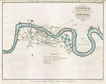
|
| Full Title: |
|
| Date: |
1799 |
| Map Maker: |
C. T. Cracklow, 1803. |
| Published: |
Ordered by the House of Commons to be Printed 11th July 1799; - And to be Re-printed 1803. |
| Size: |
38cm x 49cm (15" x 19") |
| Extent: |
St Paul's Churchyard - Woolwich Reach - Greenwich - Lambeth Reach |
| Source: |
The Second Report (1799) From The Select Committee Upon The Improvement Of The Port Of London 1803 |
| Notes: |
Plan showing layout of proposed Surrey docks at Rotherhithe, and the line of a proposed 2¼ mile canal from the docks to Bank Side. |
|
| London 1800s - 19th Century |
Map Of London Environs
1800
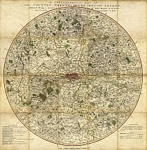
|
| Full Title: |
|
| Publisher: |
William Faden, Charing Cross |
| Date: |
September 1st, 1800 |
| Size: |
Circular 56cm diameter (22" diameter) |
| Scale: |
½" : 1 statute mile |
| Extent: |
Chelsing - Tilbury - Dorking - Eton. |
| Description: |
Folding map, hand coloured in outline, with parks coloured. Explanation bottom left and bottom right outside map. Imprint and scale below.
(Howgego Pg 142)
This map is recorded in Howgego as No. 193 (2). The first edition of this map was published by Faden in 1790. The date imprint of this edition has been changed to "Sepr 1st 1800". Paddington Canal is shown on the map.
|
|
Map Of London
1801
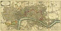
|
| Full Title: |
|
| Publisher: |
John Wallis, No.16 Ludgate Street |
| Date: |
January 24th 1801 |
| Size: |
89cm x 45cm (35" x 17¾") |
| Scale: |
6¼" : 1 statute mile |
| Extent: |
Pentonville - Stepney - Lambeth - Hyde Park |
| Description: |
Folding map. Slipcase in poor condition, though label is better preserved. Hand coloured sections laid down on linen. Title on oval at top left. Explanation of symbols, Hackney-Coach Fares and Scale at bottom right. This map is extended East by an extra sheet 17¾" x 8¼", from Rotherhithe to Stepney.
An unrecorded variant of Howgego No. 214 (4), this copy does not include the additional title "The Isle Of Dogs and the New Docks for the West India Trade" in an oval at the top left as cited in Howgego, nor the imprint "Published May 18th 1801 by J. Wallis". |
|
Map Of London
1804

|
| Full Title: |
|
| Publisher: |
John Wallis, No.16 Ludgate Street |
| Date: |
January 24th 1804 |
| Size: |
117.5cm x 43.9cm (46¼" x 17¼") |
| Scale: |
6¼" : 1 statute mile |
| Extent: |
Pentonville - Abbey Marsh - Lambeth - Hyde Park |
| Description: |
Folding map. Hand coloured sections laid down on linen. Title on oval
at top left. Explanation of symbols, Hackney-Coach Fares and Scale at bottom right.
This map is extended east by an extra sheet 11¾" (30.0cm) wide, from Stepney to Greenwich Marsh. Additional title "The Isle Of Dogs and the New Docks for the West India Trade" in an oval at the top left.
Howgego No. 214 (4-5) |
|
Map Of London
1814
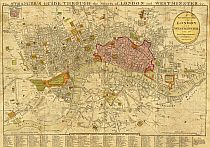
** With Basic Street Search **
|
| Full Title: |
|
| Second Title: |
A New and Correct Plan of London and Westminster with the latest Improvements.
|
| Slipcase Title: |
Wards Plan of London. Printed & Sold by W & T. Darton, Holborn Hill.
|
| Publisher: |
Pubd. Jany 12th 1814 by Willm. Darton, 58 Holborn Hill, London.
|
| Date: |
1814 |
| Size: |
35.5cm x 56cm (14" x 22") |
| Scale: |
3¾" : 1 Statute Mile |
| Extent: |
Somers Town - Ratcliffe - Walworth - Knightsbridge |
| Description: |
First title in top border. Second title in oval at top right. Compass star and map scale at bottom right. Plan of the Rules of the Fleet Prison inset at top left. Map divided into squares lettered for reference and table of references below map. City area, open spaces, etc., are coloured.
Includes a "List of 200 principal streets with letters of reference to their situation" in the bottom margin.
Recorded in Howgego as No. 245 (4). |
|
Map Of London
1817
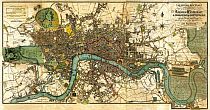
|
| Full Title: |
|
| Publisher: |
Published July 1st 1817 by W. Darton, Junr. 58 Holborn Hill.
|
| Date: |
July 1st 1817 |
| Size: |
91.8cm x 47.1cm (36" x 18½") |
| Scale: |
3¾" : 1 Statute Mile |
| Extent: |
Somers Town - Ratcliffe - Walworth - Knightsbridge |
| Description: |
Folding hand-coloured map of London. Hand coloured sections laid down on linen. Title at top right. Explanation and Scale at top left.
Howgego No. 268 (2)
|
|
Map Of London 1817
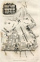
|
| Full Title: |
|
| Map Maker: |
David Hughson |
| Date: |
1817 |
| Source: |
Taken from "Walks Through London, Including Westminster and the Borough of Southwark, with the Surrounding Suburbs; Describing Every Thing Worthy of Observation in the Public Buildings, Places of Entertainment, Exhibitions, Commercial and Literary Institutions, &c. Down to the Present Period. Forming a complete Guide To The British Metropolis, In Two Volumes", by David Hughson, L.L.D. 1817. Printed for Sherwood, Neely, and Jones, Paternoster-Row, London; et al., 1817. |
| Publisher: |
Published by W. Clarke, New Bond Street, Mar. 1. 1817.
|
| Size: |
13cm x 21cm (5" x 8¼" Approx) |
| Extent: |
Hyde Park - Regent Street - Westminster Bridge - Tothill Fields |
| Notes: |
This walk, taken from Volume II, shows the "Propos'd New St." north of Carlton House, which became Regent Street.
The page also displays an engraved view of The Treasury, Westminster, and shows:
Hyde Park Corner, Turnpike, Grosvenor Place, Piccadilly, Queen's Palace, Garden, Constitution Hill, Green Park, The Road To Chelsea, Bason, Pimlico, Green Coat School, Bridewell, Tothill Fields, Grey Coat School, Peter Street, Almonry, Queen Square, St James's Park, Pagoda Bridge, St James's Street, Pall Mall, Palace, Marlborough House, Carlton House, Proposed New Street (Regent Street), St John Church
Yard, Horse Ferry, Millbank Street, College Garden, Old Palace Yard, Sanctuary, New Palace Yard, House of Lords, House Of Commons, Westminster Bridge, Privy Garden Stairs, Admiralty, Horse Guards, Treasury, Whitehall, Charing Cross, Scotland Yard, Northumberland House, & Whitehall Stairs. |
|
Map Of London 1817
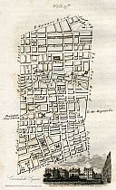
|
| Full Title: |
|
| Map Maker: |
David Hughson |
| Date: |
1817 |
| Source: |
Taken from "Walks Through London, Including Westminster and the Borough of Southwark, with the Surrounding Suburbs; Describing Every Thing Worthy of Observation in the Public Buildings, Places of Entertainment, Exhibitions, Commercial and Literary Institutions, &c. Down to the Present Period. Forming a complete Guide To The British Metropolis, In Two Volumes", by David Hughson, L.L.D. 1817. Printed for Sherwood, Neely, and Jones, Paternoster-Row, London; et al., 1817. |
| Publisher: |
Published by W. Clarke, New Bond Street, Apr. 1. 1817.
|
| Size: |
13cm x 21cm (5" x 8¼" Approx) |
| Extent: |
Edgeware Road - The New Road To Paddington - Tottenham Court Road - Oxford Street |
| Notes: |
This walk, taken from Volume II, shows the "Projected New Street" north of Oxford Street running into Portland Place. This became the north end of Regent Street.
The page also displays an engraved view of Cavendish Square, and shows:
Edgeware Road, Great Cumberland Street, Great Quebec Street, Portman Square, Baker Street, Manchester Square, High Street, Welbeck Street, Wimpole Street, Cavendish Square, Harley Street, Projected New Street (Regent Street), Portland Place, Road To Regent's Park, Great Portland Street, Portland Road, Berner's Street, Hospital, Fitsroy Square, Charlotte Street, John Street, Tottenham Court Road, The
New Road To Paddington, & Oxford Street. |
|
Map Of London
c1820
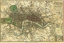
|
| Book Title: |
Pigot & Co.'s Metropolitan Guide & Book Of Reference
To Every Street, Court, Lane, Passage, Alley And Public Building, In The Cities
Of London & Westminster, The Borough Of Southwark, And Their Respective Suburbs.
Compiled & Arranged from Actual Survey & accompanied with a New Plan of London
divided into Seventy districts, which are referred to by figures in the Street
& List. - The whole made so easy of Comprehension as to be essentially valuable
to Strangers, & of the greatest use to the resident Nobility, Gentry, Merchants,
Tradesmen, &c. |
| Map Title: |
Pigot & Co.'s Miniature Plan Of London & Vicinity, With The Geographical
Bearings From The Dome Of St. Pauls.
Formed into 70 Divisions by means of Circular &c. lines each Circle being
6 Furlongs or ¾ of a Mile from the next when measured in a direct line. |
| Publisher: |
J. Pigot & Co. 24 Basing Lane, London, & 16
Fountain St., Manchester |
| Date: |
c1820 |
| Size: |
27cm x 41.3cm (10¾" x 16¼") |
| Scale: |
c17/8" : 1 statute mile |
| Extent: |
Islington - East India Docks - Camberwell - Kensington
Gardens |
| Description: |
Folding map, included with Pigot & Co.'s Metropolitan
Guide. Title at top right. Scale near bottom centre. 70 divisions of map numbered
for reference to the street index. Waterloo and Southwark Bridges and Stamford
Street shown, but not York Road, Lambeth. Carlton House shown. |
|
Map Of London
1827
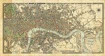
|
| Full Title: |
|
| Publisher: |
G.F. Cruchley, Map-Seller, 38 Ludgate Street, London. |
| Date: |
1827 |
| Size: |
44cm x 92cm (17¼" x 24") excluding border |
| Scale: |
4&7/8" : 1 statute mile |
| Extent: |
Hoxton - East India Docks - Walworth - Brompton |
| Description: |
Engraved and Published from a plan by Arrowsmith. Folding
plan, with hard cover slipcase. Hand coloured sections laid down on linen. Title
set in top border. Imprint and reference to symbols in lower border. References
to size and date of opening of docks in lower border. |
|
St. Marylebone Church
c1829
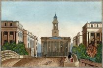
|
| Title: |
|
| Source: |
Les Capitales De L'Europe. Promenades Pittoresques. |
| Author: |
M. Charles Malo. |
| Publisher: |
Paris. Marcilly Fils Aine, Rue S.-Jacques, No 21. |
| Date Published: |
1829 |
| Size: |
Image: 11.7cm x 7.6cm (4½" x 3")
Page: 14.8cm x 9cm (5¾" x 3½") |
| Description: |
Hand-colored aquatint of the Parish or St. Marylebone, from Charles Malo's series on the capitals of Europe. Fine condition, due to presence of a tissue guard, which seems to have been lately removed.
Charles Malo (1790-1871) produced a series of books on the capital cities of Europe, including Berlin, Constantinople, Londres, Madrid, Paris, Rome, St. Petersbourg, and Vienne.
The volumes, in French, record details of daily life in the cities, historical information, and architectural details of churches and significant public buildings. |
|
Map Of London
c1830
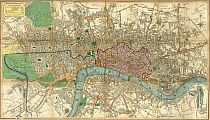
|
| Full Title: |
|
| Publisher: |
Charles Smith, 172 Strand. |
| Date: |
c1830 |
| Size: |
61cm x 34.5cm (24" x 13½") |
| Scale: |
3½" : 1 statute mile |
| Extent: |
Islington - Limehouse - Newington Butts - Hyde Park. |
| Description: |
Folding plan, with hard cover. Hand coloured sections laid down on linen. Title on cover only. Explanation top left. Compass rose top right. Scale bottom right. Boundaries etc. coloured to accord with the explanation. New and Old London Bridge shown, also St Katharine's Dock (opened 1828). New London Bridge shown as an "Intended Improvement" (it opened in 1831).
Howgego No. 328 (1)
|
|
Map Of London
1834
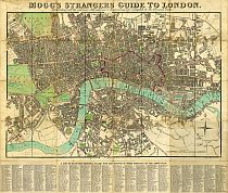
|
| Full Title: |
|
| Publisher: |
Edward Mogg, No. 14 Great Russell Street, Covent Garden |
| Date: |
January 1st. 1834 |
| Size: |
60cm x 50.5cm (23½" x 19¾") |
| Scale: |
3¾" : 1 statute mile |
| Extent: |
Pentonville - Ratcliff - Kennington - Brompton. |
| Description: |
Folding map. Slipcase missing. Hand coloured sections
laid down on linen. Title in top margin. Imprint below map in bottom margin. Date
added above compass star. Map squared and margins lettered and numbered for reference.
List of 500 "Principal Places" below map. |
|

Map Of St. Marylebone
1834
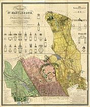
|
| Full Title: |
Topographical Survey Of The Borough Of St. Marylebone, As Incorporated & Defined By Act Of Parliament 1832. Embracing & Marking The Boundaries Of The Parishes Of St. Marylebone, St. Pancras, & Paddington, Also The Extents & Limits Of The Principal Landed Estates Within The Borough, And Plans & Elevations Of The Public Buildings.
Engraved by B.R. Davies From Surveys & Drawings By F.A. Bartlett Under The Direction Of John Britton F.S.A. &c. &c. &c.
Inscribed To The Dukes Of Bedford, Portland, & St. Albans, The Marquis Camden, The Lord Bishop Of London, Lords Mansfield & Southampton, E.B. Portman, Esq., & Other Landed Proprietors. |
| Mapmaker: |
Engraved by B.R. Davies From Surveys & Drawings By F.A. Bartlett Under The Direction Of John Britton F.S.A. &c. &c. &c. |
| Publisher: |
London. Published June 25, 1837; By J. Britton, Burton Str. J. Taylor, 30 Upper Gower Str. & B.R. Davies, 16 George Str. Euston Squ: |
| Date Of Map: |
1834 |
| Date Published: |
25 June 1837 |
| Size: |
114.5cm x 95cm (45" x 37½")
Each Section 28.5cm x 24cm (11¼" x 9½") |
| Scale: |
8.81" : 1 British Statute Mile
5" : 1000 Yards (Approx.) |
| Extent: |
St. Marylebone - St. Pancras - Paddington |
| Description: |
Folding map of St. Marylebone. 16 hand coloured sections laid down on linen, folding into a hardback cover, in good condition. The map is in excellent condition, with only minor offsetting and age toning.
The label on cover reads "Survey Of The Borough Of St. Mary-le-bone 1834." The information on the map is updated to 1834.
The map records:
London & Birmingham Railway - began 1834
Christ Chapel, Northwick Terrace - 1834 |
|
Buildings Of St. Marylebone
1834
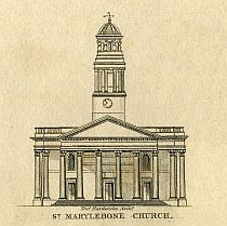
|
| Title: |
|
| Source: |
Topographical Survey Of The Borough Of St. Marylebone, As Incorporated & Defined By Act Of Parliament 1832. Embracing & Marking The Boundaries Of The Parishes Of St. Marylebone, St. Pancras, & Paddington, Also The Extents & Limits Of The Principal Landed Estates Within The Borough, And Plans & Elevations Of The Public Buildings.
Engraved by B.R. Davies From Surveys & Drawings By F.A. Bartlett Under The Direction Of John Britton F.S.A. &c. &c. &c.
Inscribed To The Dukes Of Bedford, Portland, & St. Albans, The Marquis Camden, The Lord Bishop Of London, Lords Mansfield & Southampton, E.B. Portman, Esq., & Other Landed Proprietors. |
| Mapmaker: |
Engraved by B.R. Davies From Surveys & Drawings By F.A. Bartlett Under The Direction Of John Britton F.S.A. &c. &c. &c. |
| Publisher: |
London. Published June 25, 1837; By J. Britton, Burton Str. J. Taylor, 30 Upper Gower Str. & B.R. Davies, 16 George Str. Euston Squ: |
| Date Of Map: |
1834 |
| Date Published: |
25 June 1837 |
|
Environs Of London
1837
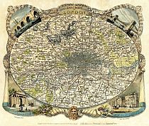
|
| Full Title: |
|
| Map Maker: |
Thomas Moule |
| Engraver: |
Engraved for Moules English Counties by W. Schmollinger |
| Date: |
1837 |
| Source: |
Taken From Moule's "The English Counties Delineated; or, A Topographical Description Of England." |
| Publisher: |
George Virtue & Co. |
| Size: |
26.7cm x 20.9cm (10½" x 8¼") |
| Scale: |
1" : 21/3 Miles (Approx) |
| Extent: |
Bounds Green - Barking - Norwood - Hanwell |
| Description: |
Hand coloured engraved paper map of London. Imprint and scale below map. Based on James Bingley's Environs Of London map published 3 Nov 1828 ( Howgego No. 315).
Oval foliate and cornucopia vignette border, with image of Old Father Thames bottom centre. The cornucopia contain (left) fruit, flowers and wheat, representing Agriculture, and (right) ivory, gold chain, pearls, jewels and coins, representing Commerce.
This is a pretty little map of equal artistic and cartographic merit.
|
|
|
|
Map Of London
1837
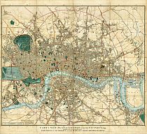
|
| Full Title: |
|
| Slipcase Title: |
Cary's New Map Of London, And Its Adjacent Villages, Published By Order Of His Majesty's Postmaster General, Showing The Present Boundary Of The Two-Penny Post Delivery, And The Limits Of The Hackney Coach Back Fares. |
| Publisher: |
G. And. J. Cary, 86, St. James's Street. |
| Date: |
1837 |
| Size: |
83.2cm x 77.2cm (32¾" x 30½") |
| Scale: |
4¼" : 1 Statute Mile (Approx.) |
| Extent: |
Stoke Newington - East India Dock - North Brixton - Kensington |
| Description: |
Folding plan, with hard cover slipcase. Hand coloured, laid down on linen. Title in bottom margin. Scale bottom left. Note regarding limit of two-penny post bottom left. No publishers imprint. Map divided into squares lettered for reference. City boundary, open spaces, etc., coloured. Position of Hungerford Bridge shown.
This state recorded as Howgego No. 279 (11). |
|
Map Of London Docks
1841
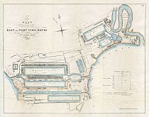
|
| Full Title: |
|
| Publisher: |
C.B. Graham, Lithographer, Washington D.C. |
| Date: |
15th April 1841 |
| Size: |
54cm x 42cm (21¼" x 16½")
|
| Source: |
United States Senate Document G.2., 30th Congress, 2nd Session.
|
| Scale: |
1" : 421 Feet (Approx.) |
| Extent: |
Bromley Marsh - River Lea - Timber Pond - River Thames. |
| Description: |
Folding plan on 19th century paper. Hand coloured plan, backed with archival tissue. Title at top left. Very good condition. |
|
Map Of London
1844
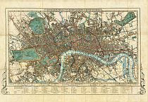
|
| Full Title: |
|
| Publisher: |
J. Cross, 18, Holborn Hill, opposite Furnivals Inn. |
| Date: |
1844 |
| Size: |
72cm x 43.7cm (28½" x 17¼") |
| Scale: |
3½" : 1 statute mile |
| Extent: |
Islington - Limehouse - Walworth - Kensington. |
| Description: |
Hand coloured folding map of London, dissected and mounted on linen. Paper label adhered to endpaper reads "John Betts, Map Publisher, 115 Strand".
Title set in top border. Explanation of colours and imprint set in bottom border. The railways entering London are coloured blue.
No date on map. Moorgate Street and location of Hungerford Bridge shown, confirming this edition as Howgego No. 360 (2).
Map divided into half mile squares and margins lettered and numbered for reference. References to Public Buildings, Exhibitions &c., Theatres, Police Offices, and Miscellaneous Buildings below bottom margin. Decorative motifs at corners.
The bottom margin includes the map price "In Sheet 2s/6d", and "In Case 4s/-"
Lacking slipcase. A fine example of this map. |
|

Panorama Of London
1845


** With Place Name Search **
|
| Full Title: |
Panorama Of The River Thames In 1845. Given With The Illustrated London News.
Supplement To The Illustrated London News, January 11, 1845. |
| Artist: |
Smyth |
| Engraver: |
Printed
and Published
by William
Little,
198, Strand |
| Publisher: |
Published With The Illustrated London News, At The Office, 198, Strand, London |
| Date: |
Saturday,
January
11, 1845 |
| Sheet Size: |
39.4cm
x 244.5cm
(15½"
x 96¼") |
| Engraving Size: |
29.7cm
x 238.8cm
(11¾" x
94") |
| Extent: |
Vauxhall Bridge to Greenwich |
| Description: |
This balloon or birds-eye panoramic view of the River Thames and London was issued as a Supplement to the Illustrated London News on Saturday, 11 February 1845. The panorama is in excellent condition, with visible fold lines as issued. It has been engraved in sections, which have been assembled in two halves for publication. |
|
Map Of London
1850
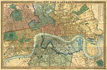
@
london1850.com
|
| Full Title: |
|
| Publisher: |
J. Cross, 18, Holborn Hill, opposite Furnivals Inn. |
| Date: |
January 1st. 1850 |
| Size: |
102cm x 63.5cm (40" x 25") |
| Scale: |
4½" : 1 statute mile |
| Extent: |
Islington - East India Docks - Peckham - Hyde Park.
8 miles East to West & 5 miles North to South. |
| Description: |
Folding plan, with hard cover slipcase. Hand coloured
sections laid down on linen. Title set in top border. Explanation and imprint
set in bottom border. Date added below imprint. Map divided into half miles and
margin marked off in half miles. References to parishes at top right. |
|
Map Of London
1851
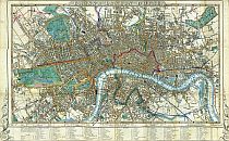
@
london1851.com
|
| Full Title: |
|
| Label Title: |
Cross's London Street Directory 1851 |
| Publisher: |
J. Cross, 18, Holborn Hill, opposite Furnivals Inn. |
| Date: |
1851 |
| Size: |
72cm x 43.7cm (28½" x 17¼") |
| Scale: |
3½" : 1 statute mile |
| Extent: |
Islington - Limehouse - Walworth - Kensington. |
| Description: |
Folding map of London. Printed on silk. Hand coloured. Paper label adhered to back of silk. Title set in top border. Explanation of colours and imprint set in bottom border. No date on map. Map divided into half mile squares and margins lettered and numbered for reference. References to Public Buildings, Exhibitions &c., Theatres, Police Offices, and Miscellaneous Buildings
below bottom margin. Decorative motifs at corners. Howgego No. 360 (4) |
|
Map Of London
1857
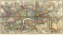
|
| Full Title: |
|
| Cover Title: |
Post Office Directory Map Of London With Patent Index. |
| Publisher: |
Kelly & Co., Post Office Directory Printing Offices, 18 to 21 Old Boswell Court, Clements Inn, Strand. (W.C.) |
| Date: |
1857 |
| Size: |
69.1cm x 39.1cm (27¼" x 15½") |
| Scale: |
3" : 1 statute mile |
| Extent: |
Dalston - East India Docks - Camberwell - Bayswater. |
| Description: |
Title and imprint at top right. Scale in bottom margin. Very early Tape Indicator map, with full index and references to every street shown on map.
Printed by Maclure, Macdonald & Macgregor's New Patent Machine. 37 Walbrook, London.
|
|
Panorama Of Chelsea
1859
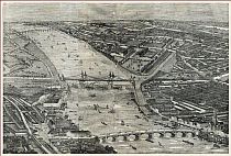
|
| Full Title: |
The West-End Railway District, London.
The Illustrated London News
April 9, 1859. |
| Artist: |
Unknown |
| Engraver: |
Unknown |
| Publisher: |
Illustrated London News |
| Date: |
9 April 1859 |
| Sheet Size: |
40.5cm x 56.5cm (16" x 22¼") |
| Engraving Size: |
34.5cm x 52cm (13¾" x 20½") |
| Extent: |
Battersea to Chelsea |
| Description: |
Engraved and published for the Illustrated London News, on
bright, good quality newspaper. Central fold as issued. Key to the view included
in the volume. |
|
Map Of London
1861
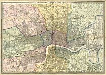
|
| Full Title: |
|
| Slipcase Title: |
Cross's London. A New Plan Of The Metropolis. |
| Publisher: |
J. Cross, 18, Holborn Hill, Opposite Furnivals-Inn. |
| Lithographer: |
E. Weller, Lithogr, 34, Red Lion Square. |
| Date: |
January 1st. 1861 |
| Size: |
125.5cm x 87cm (49½" x 34¼") |
| Scale: |
Nearly 4¾" : 1 statute mile |
| Extent: |
Upper Holloway - East India Dock - North Brixton - Kensal Green.
9¾ miles East to West & 6¾ miles North to South |
| Description: |
Folding plan, with hard cover slipcase. Hand coloured, laid down on linen. Title set in top border. Explanation and imprint set in bottom border. Date added below imprint. Map divided into half miles and margin marked off in half miles. References to parishes at right. |
|
Panorama Of London
1861

|
| Full Title: |
London From The South Side Of The Thames.
Supplement To The Illustrated London News,
February 9, 1861. |
| Artist: |
Thomas Sulman del. |
| Engraver: |
Robert Loudan Sr. |
| Publisher: |
Illustrated London News |
| Date: |
9 February 1861 |
| Sheet Size: |
57.5cm x 144cm (22½" x 56¾") |
| Engraving Size: |
43cm x 132cm (17" x 52") |
| Extent: |
Millbank to St Catharine's Dock |
| Description: |
Engraved and published as a supplement to the Illustrated London
News, on bright, good quality newspaper. Folded as issued. Key to the view included. |
|
Map Of London
1864
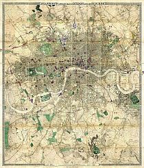
@
london1864.com
|
| Full Title: |
|
| Publisher: |
Published by Edward Stanford, 6 Charing Cross, London, S.W. |
| Date: |
1864, with later overlay post-1866 |
Total Size:
|
1690mm Wide x 1920mm High (66½" Wide x 72½" High) |
| Scale: |
6" : 1 Mile |
| Extent: |
Crouch End - Greenwich - Anerley - Hammersmith |
| Description: |
Large scale and highly detailed map of London, with proposed Metropolitan railway lines and improvements overlaid in various colours, numbered. |
|
Map Of London
1865
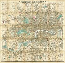
|
| Full Title: |
|
| Publisher: |
Josiah Whitbread, Map-Seller, 142, Oxford Street. |
| Date: |
April 1865 |
| Size: |
77.5cm x 74.5cm (30½" x 29¼") |
| Scale: |
3" : 1 statute mile |
| Extent: |
Kenwood - Bow Common - Brixton Hill - Hammersmith |
| Description: |
Coloured folding map on paper, laid down on linen. Hard
card cover. Title at centre in top border. Imprint, explanation of railway symbols,
and scale in bottom border. Divided into squares lettered and numbered in border
for reference. Includes street index. |
|
Map Of London
1868
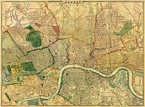
@
london1868.com
|
| Title: |
London |
| Mapmaker: |
Compiled And Engraved By Edward Weller, F.R.G.S. (Fellow of the Royal Geographical Society)
Revised And Corrected To The Present Time By John Dower, F.R.G.S. John Dower, 1866. |
| Publisher: |
London G.W Bacon & Co. 337 Strand WC. |
| Scale: |
9⅜" : 1 Statute Mile |
| Date: |
Updated by Bacon to 1868 |
| Size: |
197cm x 142cm (77½" x 56") |
| Extent: |
Upper Holloway - Poplar - Kennington - North Kensington |
| Description: |
Hand-coloured map, dissected and mounted on linen. 36 sections each measuring 33cm x 24cm (13" x 9½")
Not recorded in Hyde, but would be No. 73, between states (6) and (7). |
|

Map Of London
1872
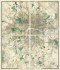
@
london1872.com
|
| Full Title: |
|
| Publisher: |
Edward Stanford, 6 & 7 Charing Cross, S.W. |
| Date: |
1872 |
Total Size:
|
1730mm Wide x 1980mm High (68" Wide x 78" High) |
| Scale: |
6 Inches to 1 Eng. Statute Mile; or, 1 Inch to 880 Feet; or, as 1:10560 on the Ground. |
| Extent: |
Crouch End - Greenwich - Anerley - Hammersmith |
| Description: |
Hand-coloured map, dissected and mounted on linen. 80 sections each measuring 170mm Wide x 245mm High (6¾" x 9½"). |
|
Map Of London
c1872
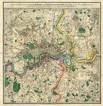
|
| Full Title: |
|
| Slipcase Title: |
London & Envs. James Wyld, Geographer To Her Majesty. 457 Strand. Charing Cross. (East.) 2 Doors Down From Trafalgar Square. Maps, Charts, Globes, & Geographical Works Of Every Description.
|
| Publisher: |
Published By James Wyld, Successor To Mr. Faden, Geographer To Her Majesty, Charing Cross East.
|
| Date: |
The slipcase label includes a handwritten date of 1872. |
| Size: |
75cm x 77.5cm (29½" x 30½") |
| Scale: |
2": 1 Statute Mile |
| Extent: |
Edmonton - Plumstead - Croydon - Chiswick |
| Description: |
Title imprint in border above map. The margin is divided into miles N, S, E, & W of the meridian and parallel of St. Paul's, County boundaries, roads, etc., are coloured. No key or hatching symbols.
(Source: Howgego No. 250)
A later variant of Howgego No. 250. Dated at c1872, but actual date to be determined.
A note in the bottom margin reads:
NB. The Circle round London denotes the extent of the Four Mile Radius, and beyond which Hackney Carriages charge Back Fares. |
|
Map Of London Parishes
1877
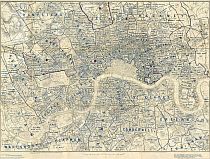
|
| Full Title: |
|
| Publisher: |
Published by Edward Stanford, 55, Charing Cross, London. |
| Date: |
Original map published July 2nd, 1875. This copy revised July 1877. |
| Size: |
79cm x 58.5cm (31" x 23") |
| Scale: |
3" : 1 statute miles |
| Extent: |
Holloway - River Lea - Clapham Common - Hammersmith |
| Description: |
Folding map. Sections laid down on linen. Hand coloured in outline. Explanation, scale bar, and imprint in bottom margin. The population of each district is shown.
Recorded in Hyde as No. 157 (1).
|
|
Map Of The City Of London
1877
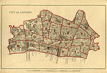
|
| Full Title: |
|
| Publisher: |
Stanford's Geogl. Estabt. London |
| Date: |
1877 |
| Size: |
28.7cm x 17.8cm (11¼" x 7") |
| Scale: |
6" : 1 Mile |
| Extent: |
City of London |
| Description: |
Title top left. Imprint and scale in bottom margin.
The School Board Of London map, City of London Division, is recorded in Hyde as No. 168 [ii]. |
|
Map Of Westminster
1877
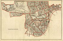
|
| Full Title: |
|
| Publisher: |
Stanford's Geogl. Estabt. London |
| Date: |
1877 |
| Size: |
28.7cm x 17.8cm (11¼" x 7") |
| Scale: |
6" : 1 Mile |
| Extent: |
Westminster |
| Description: |
Title bottom left. Imprint and scale in bottom margin.
The School Board Of London map, Westminster Division, is recorded in Hyde as No. 168 [x]. |
|
Map Of London
1878
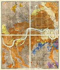
@
london1878.com
|
| Full Title: |
|
| Publisher: |
Published by Edward Stanford, 55 Charing Cross Road SW, May 1st 1878 |
| Date: |
1878 |
| Size: |
On 4 sheets, each 865mm Wide x 990mm High (34" Wide x 39" High) |
Total Size:
|
1730mm Wide x 1980mm High (68" Wide x 78" High) |
| Scale: |
6" : 1 Mile; Or, 1 Inch To 880 Feet |
| Extent: |
Crouch End - Greenwich - Anerley - Hammersmith |
| Description: |
Corrected to 1 January 1877. Republished with the geological colouring on 1 May 1878. |
|
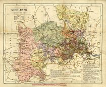
Map Of Middlesex
c1883
|
| Full Title: |
|
| Publisher: |
Ordnance Map Department. Forster Groom & Co., Geographers & Map Specialists. 15 Charing Cross, London , S.W. Near Whitehall. |
| Printer: |
Letts, Son & Co. Limited, London. |
| Date: |
c1883 |
| Size: |
44cm x 35.5cm (17¼" x 14") |
| Scale: |
Approx ½" : 1 statute mile |
| Extent: |
South Mims - Woolwich - Walton On Thames - Windsor. |
| Description: |
Folding paper map, linen backed, with hard cover. Printed colour. Title, Scale and Middlesex Statistics top left. Explanation Of Signs bottom centre. Some London Statistics bottom right. Publisher's label pasted on at bottom center. Stained and foxed, but generally in good condition. Divided into squares lettered in upper and lower case in border for reference. The reference index is not included
with this map.
|
|
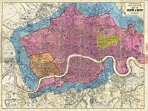
Map Of London
1886
|
| Title: |
|
| Overlaid Title: |
Metropolitan Goods Conference. Map Of Collection & Delivery Boundaries. January 1st 1886. |
| Publisher: |
Lithog. Kelly & Co. London & Kingston.
Printed & Published By Kelly & Co. Post Office Directory Office, 51 Great Queen Street, Lincoln's Inn Fields, London. W.C.
|
| Date: |
January 1st 1886 |
| Size: |
66cm x 90cm (26" x 35½") |
| Scale: |
3": 1 Statute Mile |
| Extent: |
Highgate - Plaistow - Dulwich - Chiswick |
| Description: |
Paper title stuck over previous map title top right. Scale bar top right.
Paper labels stuck on in right hand margin:
"The Pink Boundary Includes St. George's Road, Green Street To Upton Park Station (L.T. & S.R.)"
"Includes Albert Docks And Firms Between The Docks And The River Side."
Recorded in Hyde as No. 61 (29), but with 1886 dated title similar to Hyde No. 61 (12) dated April 1st 1869.
|
|
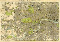
Map Of London
1897
|
| Full Title: |
|
| Publisher: |
Edward Stanford, 26 & 27, Cockspur Street, Charing
Cross, S.W. |
| Date: |
April 2nd. 1897 |
| Size: |
101cm x 68cm (40" x 27") |
| Scale: |
4" : 1 statute mile |
| Extent: |
Kentish Town - Bethnal Green - Clapham Common - Chiswick |
| Description: |
Coloured folding map on paper, laid down on linen. Hard
card cover. Title in top margin. Scale in margin at bottom left. Imprint in bottom
margin at centre. Shows omnibus routes. |
|
| London 1900s - 20th Century |
Atlas Map Of London
1908
|
| Full Title: |
|
| Title Page: |
Handy Reference Atlas Of London & Suburbs By J.G. Bartholomwe, F.R.G.S.
From Latest Surveys Showing Street Names As Altered By L.C.C.
With Complete Index To Streets, Public Buildings, Etc.
|
| Publisher: |
John Bartholomwe & Co.
The Geographical Institute, Edimburgh.
|
| Date: |
1908 |
| Size: |
14.6cm x 22.7cm (5¾" x 9") |
| Scale: |
3¼" : 1 Statute Mile |
| Extent: |
Wood Green - Plumstead - Upper Norwood - Ealing |
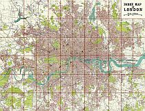
| Description: |
Atlas of London by John George Bartholomew. Slightly predates the construction of White City for the 1908 Olympic Games, although the vacant site is clearly visible.
Includes a 68 page "General Index To Streets, Public Buildings, Railway Stations, Etc."
|
|
Tube Map Of London
1911
|
| Full Title: |
|
| Publisher: |
Johnson, Riddle, & Co. Ltd., London, S.E. |
| Date: |
1911 |
| Source: |
Taken From "Cook's Handbook For London. With Two Maps And Six Plans." |
| Publisher: |
Thomas Cook & Son, Ludgate Circus. Simpkin, Marshall, Hamilton, Kent & Co., Ltd. |
| Size: |
27.2cm x 20.5cm (10¾" x 8") |
| Extent: |
Golders Green - Whitechapel - Clapham Common - South Ealing |
| Description: |
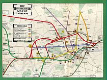
Folding paper map of London Underground. Machine colour. Bound into "Cook's Handbook For London". In very good condition.
The map includes details of the Metropolitan Railway, District Railway, City & South London Railway, Central London Railway, Great Northern & City Railway, London Electric Railway (Bakerloo Line, Piccadilly Line, & Hampstead Line), Brighton Railway (Elevated Electric), & Waterloo & City Railway.
This map will be of interest to family historians researching their family in the 1911 Census of London. |
|
Map Of Hornsey
1925
|
| Full Title: |
|
| Mapmaker: |
E.J. Lovegrove, M. Inst. C.E., Engineer & Surveyor, Town Hall, Highgate, N.6. |
| Publisher: |
Unknown |
| Date Of Map: |
July 1925 |
| Size: |
69.3cm x 56.5cm (27¼" x 22¼") |
| Scale: |
7¼" : 1 Mile |
| Extent: |
Friern Barnet Road - Finsbury Park - Seven Sisters Road - Bishops Avenue |
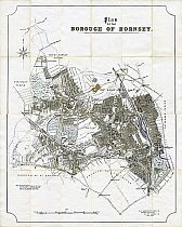
| Description: |
Folding map of the Borough of Hornsey, laid down on linen. 24 folding sections with marbled end boards. Original slipcase not present. |
|
Upcoming London Maps
To aid students, historians, and genealogists tracing their ancestry, some of
the following London and English county maps will be selected for display in coming
months:
c1517 ~ London, Westminster And Southwark As In The Olden Times Shewing The City And Its Suburbs With The Churches, Monasteries, And All The Important Buildings As They Stood In The Reign Of Henry VIII Before The Reformation. Accompanied By An Historical And Topographical Memoir Compiled From Ancient Documents, Records, & Other Authentic Sources By William Newton, Author of the "Display Of Heraldry,", &c. (Published by Wm. Newton, 66 Chancery Lane, & By Bell & Daldy, 186 Fleet Street, London. October 1855. Taken from London In The Olden Time. Being A Topographical And Historical Memoir Of London, Westminster, And Southwark, Accompanying A Pictorial Map Of The City And Its Suburbs, As They Existed In The Reign Of Henry VIII, Before The Dissolution Of Monasteries. Compiled From Ancient Documents And Other Authentic Sources By William Newton, Author Of A Display Of Heraldry. London. Published For The Author, 66, Chancery Lane, By Bell And Daldy, 186, Fleet Street. MDCCCLV )
1746 ~ An Exact Survey Of The City's Of London, Westminster Ye Borough Of Southwark And The Country Near Ten Miles Round Begun In 1741 & Ended In 1745 By John Rocque Land Surveyor & Engrau'd By Richard Parr (Photo lithographed and published by Edward Stanford, 1878. Hand coloured.)
Howgego No. 94 (i)
1753 ~ A Map Of The New Roads &c. From Westminster Bridge (Published In The Gentleman's Magazine, May 1753)
1761 ~ A New And Correct Plan Of London, Westminster And Southwark, With Several Additional Improvements Not In Any Former Survey (Engrav'd & Printed for R. and J. Dodsley in Pall-Mall, 1761. Taken from 'London And Its Environs Described', Vol. IV.)
Howgego No. 118
1761 ~ A Correct Plan Of The Cities Of London, Westminster, And The Borough Of Southwark, Including The Bills Of Mortality, With The Additional Buildings &c. (Published In The London Magazine, June 1761)
1763 ~ A New And Accurate Plan Of The Cities Of London And Westminster, Including The New Roads & New Buildings (Western half of map only. Published In The Gentleman's Magazine, 1763)
1765 ~ A New And Accurate Plan Of The Cities Of London And Westminster, And The Borough Of Southwark, With The New Roads And New Buildings, &c. To The Year 1765 (Eastern half of map only. Published In The Universal Magazine Of Knowledge And Pleasure, By John Hinton, At The King's Arms In Newgate Street, London, May 1765)
1789 ~ The Country Twenty-Five Miles Round London Planned From A Scale Of One Mile To An Inch. South East Quarter Of Map Only (Published on January 1st 1789 by Wm Faden, Charing Cross. Size: 51cm x 61cm (20" x 24"). Scale 1" : 1 Mile. Hand-coloured map of south east London & north west Kent. Extent: SE London, Mucking / Tilbury, Yalding / Tunbridge, Godstone / Bletchingley)
Howgego No. 188 (2)
1793 ~ Bowles's Reduced New Pocket Plan Of The Cities Of London And Westminster With The Borough Of Southwark, Exhibiting The New Buildings To The Year 1793 (Printed for Carington Bowles at his Map & Print Warehouse, No 69 in St Paul's Churchyard, 1793. Size: 39.6cm x 56cm (15½" x 22"). Hand-coloured map of London.)
Unrecorded variant of Howgego No. 168, being between States (8) & (9).
1798 ~ Cary's New Pocket Plan of London, Westminster, and Southwark, With all the adjacent Buildings in St George's Fields &c. &c. to which are annexed (from Authority) the exact Boundary of the Rules of the Kings Bench Prison; the situation of the receiving Houses of the General & Penny Post Offices, references to Public Buildings &c. &c. also a Correct List of upwards of 350 Hackney Coach Fares. (London, printed for J. Cary Engraver, Map & Printseller, No. 181, Strand, Jany 1, 1798. Hand-coloured map of London.)
Unrecorded variant of Howgego No. 192, being between States (5) & (6).
1804 ~ Wallis's Plan of the Cities of London and Westminster 1804. (Published Jan'y 24th 1804 by J. Wallis, No.16 Ludgate Street. An unrecorded variant of Howgego No. 214 (4-5). Map extended east on an extra sheet measuring 16¼" x 11½", entitled "The Isle Of Dogs and the New Docks for the West India Trade" in an oval at the top left. Size: 117cm x 44cm (46Ē x 17Ē). Hand-coloured map of London, dissected and mounted on linen.)
Howgego No. 214 (4-5)
1817 ~ An Entire New Plan Of The Cities Of London & Westminster, & Borough Of Southwark; The East & West India Docks, Regent's Park, New Bridges, &c. &c. With The Whole Of The New Improvements Of The Present Time. (Published July 1st 1817 by W. Darton, Junr. 58 Holborn Hill. Engraved by G. Alexander, Clarks Place, Islington. 1817. Size: 99cm x 48cm (39" x 19"). Hand-coloured
map of London.)
Howgego No. 268 (2)
1820 ~ A Plan Of The Cities Of London & Westminster, the Borough of Southwark, With The New Buildings (Published by William Faden, Geographer To The King & To HRH The Prince Of Wales. Charing Cross. 1820. Size: 91.5cm x 47cm (36" x 18½"). Hand-coloured in outline.)
Howgego No. 269 (2)
1822 ~ Map of the Country 12 Miles Round London. "The publisher having surveyed the whole of the great roads in this map and determined the exact situation of the Nobleman's and Gentleman's seats, is aware that there may be some houses omitted which from their multiplicity is unavoidable but considerable pains have been bestowed in selecting those that appear to him of most importance, but should
any material omissions occur information on the subject will be thankfully received and carefully attended to." (Published by C. Smith, No. 172 Strand, September 12th 1822. Engraved by W.R. Gardener. Size: 88cm x 75cm)
1831 ~ Plan Of The Northern Part, Of The Parish Of Lambeth, Comprehending The Ecclesiastical Districts Of St. Mary, St. John, Waterloo, And Part Of St. Mark, Kennington: Formed Out Of The Bishop's, Prince's, And Marsh And Wall Liberties, Comprising All That Now Remains Of The Auncyent Towne Of Lamhithe, Situate In Fore Street And Princes Street; With Parts Of The Adjoining Parishes Of Christ Church, St. George, Southwark, And St. Mary, Newington. By Rd. Williamson, Engraver. (London. Published Augt. 1st, 1831, By R. & E. Williamson, Engravers & Printers, 14, Moore Place, New Bethlem. R. & E. Williamson, Scrip. et Sculp. Size: 23¾" x 19" [60.3cm x 48.2cm]. Hand-coloured map of Lambeth.)
1838 ~ The Metropolitan Boroughs, As Defined by the Reform Bill (Source: England's Topographer; Or, The English Counties Delineated : The Metropolitan Boroughs Of London. Thomas Moule, London, 1838. Size: 62cm x 52cm (24½" x 20½"). Hand-coloured map of London.)
1841 ~ The Royal Gardens Vauxhall For Sale by Mr. Leifchild, 1841 (Size: 56cm x 43cm (22" x 17"). Hand-coloured map of Vauxhall.)
1842 ~ [Panoramic View Of] London In 1842 Taken From The Summit Of The Duke Of York's Column. This Picture Of The Metropolis Of The British Empire Is Presented To The Subscribers Of The Illustrated London News By The Proprietors. ( W. Little. Published by Illustrated London News, London, 1843. Size: 82cm x 117cm [32¼" x 46"])
1843 ~ Cross's New Plan of London. Slipcase label reads: Cross's New Plan Of London With All The Improvements To 1843 (London, J. Cross, 18 Holborn Hill. 1843. Size: 102cm x 66cm (40" x 26"). Hand-coloured map of London.)
Howgego No. 317 (9), although MAPCO's copy differs from the D&H description.
1844 ~ Cruchley's New Plan Of London, Shewing All The New And Intended Improvements To The Present Time. A New Edition Improved To Jany. 1st. 1844 (G.F. Cruchley, London. 1844. Size: 63.5cm x 43cm (25" x 17¼"). Hand-coloured map of London.)
Howgego No. 304 C. (7)
1844 ~ Cross's London Guide (London, J. Cross, 18 Holborn Hill, opposite Furnivals Inn. Size: 51 x 75 cm. Hand-coloured map of London.)
Howgego No. 360 (2)
1845 ~ Wallis's Guide For Strangers Through London 1845 (Published by Edward Wallis, 42 Skinner Street. Hand-coloured map of London.)
Howgego No. 301, after (10)
1845 ~ The Railway Bell And Illustrated London Advertiser Map Of London 1845. "Time, Tide & Trains Wait for No Man." Presented Gratuitously To The Subscribers To The Railway Bell And Illustrated London Advertiser (George Biggs. Published at 335, Strand, Opposite Somerset House.)
Howgego No. 380 (2)
1846 ~ Rock's Illustrated Map Of London (William Henry Rock & Co., Walbrook, 1846)
An unrecorded variant of Howgego No. 394 (1)
1850 ~ The Circuiteer: A Series Of Distance Maps For All The Principal Towns In The United Kingdom. Invented By J. Friederichs, To Serve As A Guide For Ascertaining Cab Fares, Porterage, &c. &c. No 1 London (Published by J. Friederichs, 5 Nassau Street, Soho Square.)
Howgego No. 408 (2)
1850 ~ Wyld's New Plan of London. Published By Jas. Wyld Geographer To The Queen And H.R.H. Prince Albert. (James Wyld, Charing Cross East, June 3rd 1850)
An unrecorded earlier variant of Hyde No. 25 (1)
(A great 1851 Census street finding aid)
1854 ~ From The Ordnance Survey Of The Country Thirty Miles Round London. Additions To 1854 (Published By G F Cruchley, Mapseller & Globe Maker, 81 Fleet Street, London. Additions To 1854. Size: 127cm x 101.5cm (50" x 40"). Scale 1" : 1 Mile. Hand-coloured map of the Environs of London, dissected and mounted on linen.)
(Hyde records this as Howgego No. 333)
1855 ~ Davies Map Of The Environs Of London, On A Scale Of One Inch To The Mile, Showing The Radius Of 4 Mile From Charing Cross (Drawn and Engraved by B. R. Davies, London. Published by Edward Stanford, 6, Charing Cross, London, 1855)
(Hyde records this as Howgego No. 333)
1856 - Metropolis Water Supply. Plan Distinguishing The Sites Of The Works And The Districts Severally Supplied By The Water Companies. 1856. Extent: Hornsey-Plumstead-Croydon-Hampton (Published by Day & Son, Lithographers To The Queen, 17 Gate Street, Lincolns Inn Fields. 1856)
c1857 ~ Map Of The Environs Of London Reduced From The Ordnance Survey (London. Published by Edward Stanford, 6 Charing Cross, London)
(Hyde No. 55)
1863 - Stanford's Map Of Metropolitan Railways, Bridges, Embankments, &c. Including The Proposed Railways And Other Plans. Brought Before Parliament For Session 1863. (London: Published By Edward Stanford, 6 Charing Cross, S.W. 1863. Scale: 2Ē : 1 mile.)
(Hyde M.I. 5)
1864 - A New Map Of Metropolitan Railways & Miscellaneous Improvements. Deposited At The Private Bill Office, Nov. 30, 1863, For Session 1864. (Stanford's Geographical Establishment, 6 Charing Cross, S.W.; London: Published By Edward Stanford, 6 Charing Cross. Vacher & Sons, 29 Parliament Street. Letts & Co., Royal Exchange. Decr. 21, 1863. Scale: 2Ē : 1 mile.)
(Hyde M.I. 12)
1867 ~ The Circuiteer: A Series Of Distance Maps For All The Principal Towns In The United Kingdom. Invented By J. Friederichs, To Serve As A Guide For Ascertaining Cab Fares, Porterage, &c. &c. No 1 London (Published by J. Friederichs, 5 Nassau Street, Soho Square and Simpkin Marshall & Co. 1867)
First published 1847 (Howgego No. 408) this map redrawn and published 1862 (Hyde No. 80)
c1870 ~ A New Map Of The Country Twenty-Five Miles Round London (Published by Edward Stanford, London, Wholesale & Retail Mapseller, 55 Charing Cross. c1870)
1871 ~ Davies's New Map Of The British Metropolis (Drawn and Engraved by B. R. Davies, London. Published by Edward Stanford, London, 1871)
1872 ~ The Country In The Vicinity Of London, Describing All The New Improvements, Metropolitan Boroughs And Parish Boundaries (James Wyld, 1872)
c1873 ~ Environs Of London Ordnance Survey Map Series. Scale 1" to 1 mile. 7 Maps (of 8) (Colonel Colby 1844. Published c1873)
1878 ~ Stanfordís Library Map Of London And Its Suburbs; Or, Geological Library Map Of London. On A Scale Of 6 Inches To 1 Statute Mile, Or 1 Inch To 880 Feet (Published by Edward Stanford, 55 Charing Cross Road SW, May 1st 1878)
c1880 ~ Bacon's Large Scale Ordnance Survey Of London And Suburbs With Alphabetical Index. With The Addition Of 2,500 New Streets. (Published by G. W. Bacon & Co., 127, Strand, London; Agents By Appointment For The Ordnance Maps)
1880 ~ Bird's-Eye Views Of The Principal Streets Of London. (Taken from London In 1880, by Herbert Fry)
c1882 ~ W.H. Smith & Son's Map Of Environs Of London. Scale 1 Mile to an Inch (W.H. Smith & Son, 186 Strand, c1882)
Hyde No. 171 (4)
1886 ~ Bacon's New Large-Scale Ordnance Atlas Of London & Suburbs : With Supplementary Maps, Copious Letterpress Descriptions, And Alphabetical Indexes, By George Washington Bacon. (Edited and Published by George W. Bacon, London. 1886.)
c1888 ~ Wyld's Map Of The Superficial Geology Of London And Its Environs. (London. Published by James Wyld, Geographer to the Queen, 457 West Strand, 11 & 12 Charing Cross, & 2 Royal Exchange. c1888.)
c1889 - Gall & Inglis' Handy Map & Guide To London With Index To Streets : being Cruchley's Handy Map Of London (Gall & Inglis, 25 Paternoster Square, London, & Edinburgh, c1889)
Hyde No. 235
c1890 ~ Bacon's Map Of The Environs Of London (G.W. Bacon & Co, 127 Strand)
1894 ~ Davies' Map Of The Environs Of London (Drawn and Engraved by B. R. Davies, London. Published by Edward Stanford, 26 & 27 Cockspur st., Charing Cross, S.W., London, Oct 1st 1894)
1898 ~ Map Of The County Of London Shewing The Boundary Of The Jurisdiction Of The London City Council, Also The Boundaries Of The Sanitary Districts, Parishes, District Boards Of Works, Extra Parochial Places, And The City Of London. 1898. (Published by Edward Stanford, 26 & 27 Cockspur st., Charing Cross, S.W., London. Dec. 19th 1898)
1912 ~ London. Drawn & Engraved Expressly For The Post Office Directory 1912. Scale : 4 Inches To 1 Mile. (London. Kelly's Directories Ltd., 182 to 184 High Holborn, W.C.)
For
More Free London Maps Visit

Committed To Displaying Free High Quality 16th To 19th Century London Maps & Views
|


